Skye Running 2009
Westerlands
Extravaganza
|
 |
| Stage | Start | Finish | Description |
Miles |
Route |
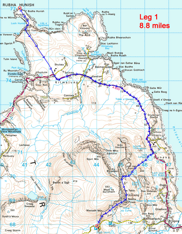
| Leg 1 | Rubha Hunish | Road Crossing NG440679 | Visits the unique and mysterious geological features of Rubha Hunish and the Quiraing. | 8.8 |
 |
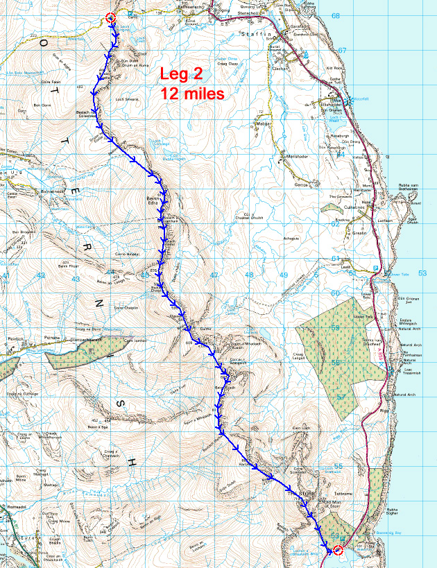
| Leg 2 | Road Crossing NG440679 | Road below The Storr | Long rolling hill stage along the Trotternish Ridge. | 12.0 |
 |
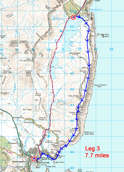
| Leg 3 | Road below The Storr | Portree Town Centre | Scenic coastal running. | 7.7 |
 |
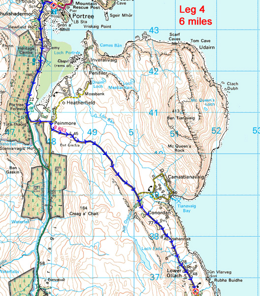
| Leg 4 | Portree Town Centre | Upper Ollach Phone Box | Easy road running. | 6.0 |
 |
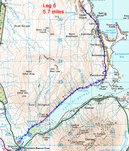
| Leg 5 | Upper Ollach Phone Box | Sligachan Campsite | Road running plus coastal path. | 5.7 |
 |
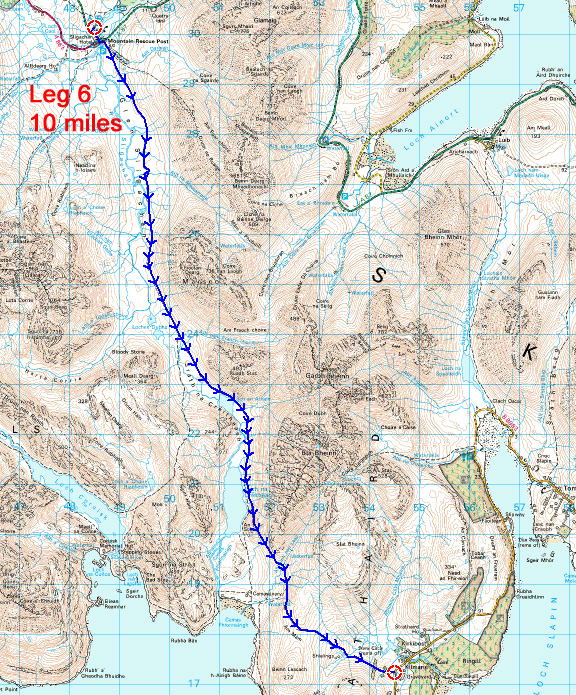
| Leg 6 | Sligachan Campsite | Kilmarie Car Park | Long dramatic section through the heart of the Cuillins. | 10.0 |
 |
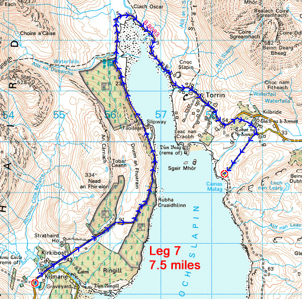
| Leg 7 | Kilmarie Car Park | Camas Malag, Torrin | Easy scenic road running beneath Blaven. | 7.5 |
 |
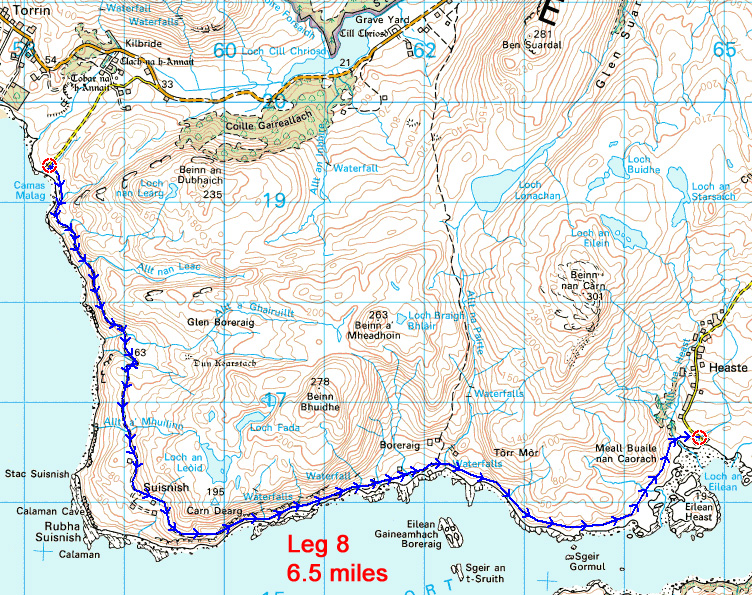
| Leg 8 | Camas Malag, Torrin | Heaste Schoolhouse | Interesting coastal trail, with amazing secluded waterfalls en route. | 6.5 |
 |
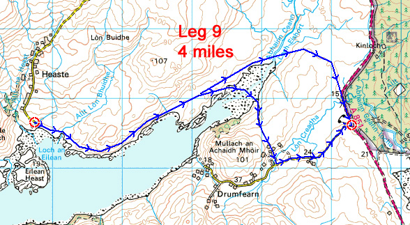
| Leg 9 | Heaste Schoolhouse | Phone box at Drumfearn Junction | Probably quite rough and boggy. Possible short cut if tide is low. | 4.0 |
 |
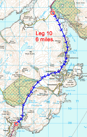
| Leg 10 | Phone box at Drumfearn Junction | Teangue Church | Easy road running. | 6.0 |
 |
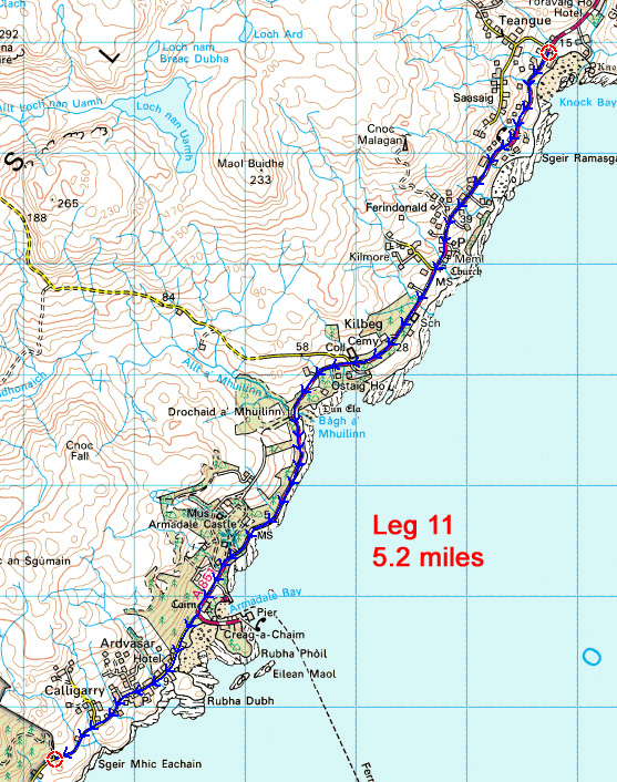
| Leg 11 | Teangue Church | Corner of Forest after Calligarry | Easy road running. |
5.2 |
 |
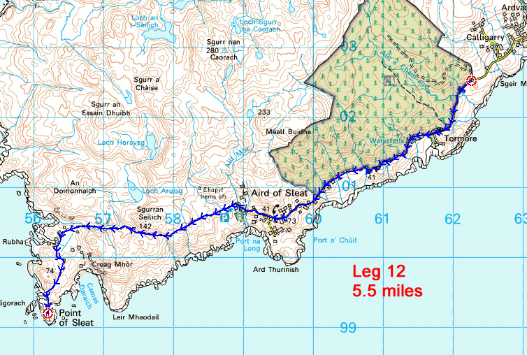
| Leg 12 | Corner of Forest after Calligarry | Point of Sleat | Road running, plus final section of track to Point of Sleat Lighthouse |
5.5 |
 |